The Literal Meaning of State and City Names in the United States
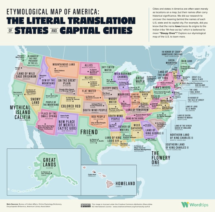
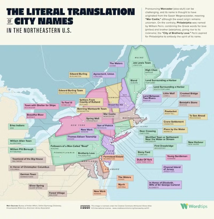
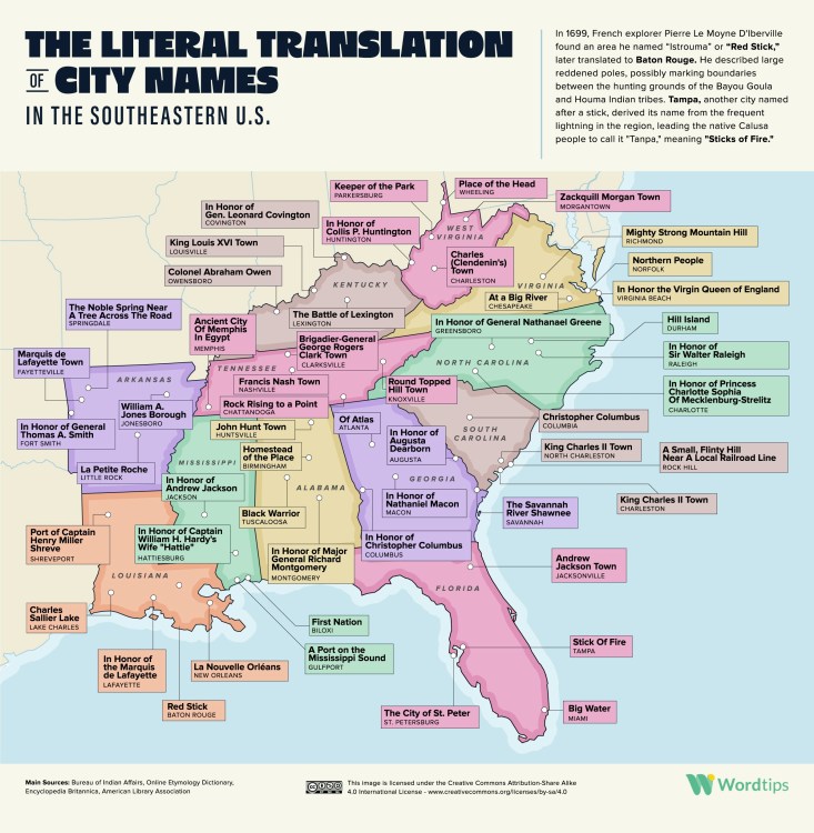
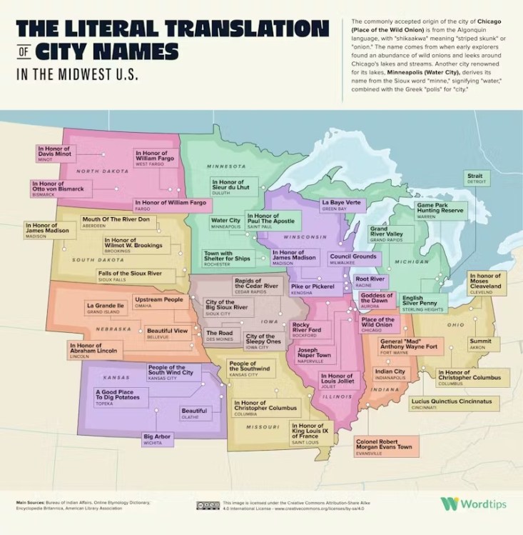
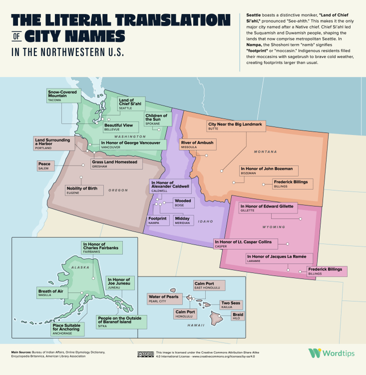
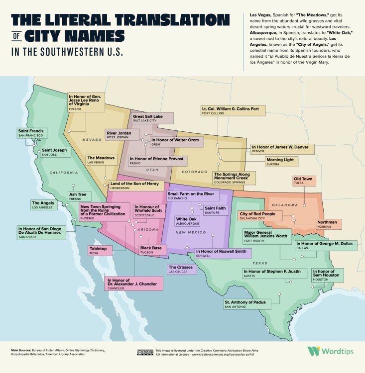
The folks at WordTips compiled an interesting set of data that plots the literal meaning of US state and city names on maps of each quadrant of the country; the Northeast, the Southeast, the Midwest, the Northwest, and the Southwest.
To know the meaning of the place names around us is to learn how the land, the history and the culture of a locality have developed over the centuries.
While RobWords previously explained the origins behind state names, these maps go into a bit more detail regarding specific locations using public sources.
Researchers at WordTips trawled a variety of sources, including the Bureau of Indian Affairs, the Online Etymology Dictionary, the Encyclopedia Britannica, the American Library Association and regional news reports to uncover the literal meaning behind the name of each U.S. state, each U.S. state’s capital city and 178 of America’s biggest cities.
