NASA Uses Ice-Penetrating Radar to Create 3D Maps of Thousands of Years of Ice in Greenland
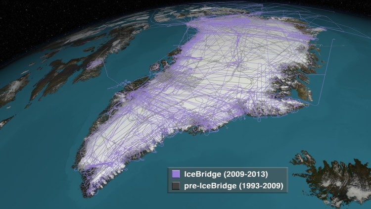
Using decades worth of data collection from ice-penetrating radar and airborne campaigns, NASA has created comprehensive 3D maps detailing thousands of years of ice build up in Greenland. Each level provides insight into global conditions of the time.
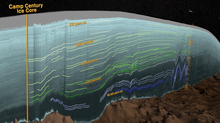
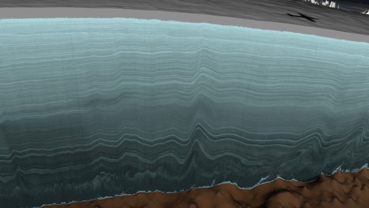
This new map allows scientists to determine the age of large swaths of Greenland’s ice, extending ice core data for a better picture of the ice sheet’s history. “This new, huge data volume records how the ice sheet evolved and how it’s flowing today,” said Joe MacGregor, a glaciologist at The University of Texas at Austin’s Institute for Geophysics and the study’s lead author.
The Greenland ice sheet, which is the second largest in the world after Antarctica, contains enough water to raise global ocean levels by 20 feet.
images via NASA