An Interactive Map That Predicts the Best Time to View Changing Leaves Within the Continental United States
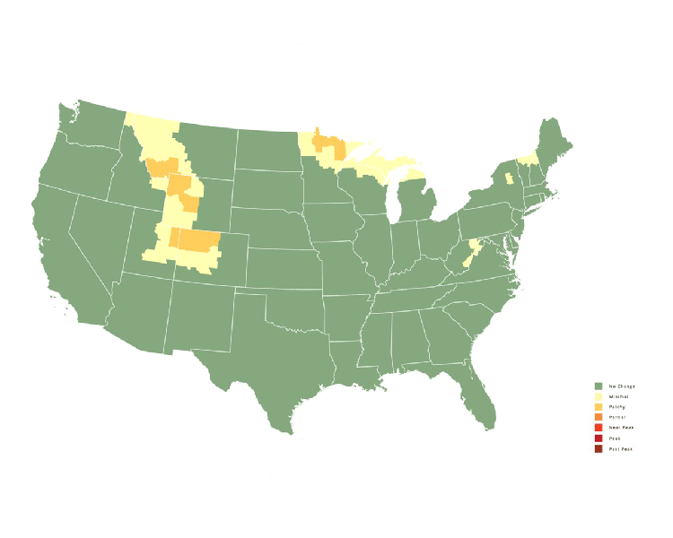
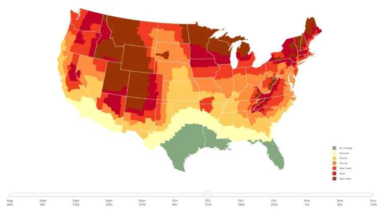
SmokyMountains.com (previously) has released its annual Fall Foliage Prediction Map for 2021. This interactive map predicts the best time to view and/or photograph the changing leaves within the continental United States. Weekly details for each area can be adjusted by sliders at the bottom to see when the foliage is expected to peak.
The 2021 Fall Foliage Map is the ultimate visual planning guide to the annual progressive changing of the leaves. While no tool can be 100% accurate, this tool is meant to help travelers better time their trips to have the best opportunity of catching peak color each year.
They also explain why leaves change color.
It all starts with photosynthesis. Leaves typically produce their vivid hues of green from spring through summer into early fall through the constant creation of Chlorophyll. …Present in other leaves and trees are the compounds known as Carotenoids and Anthocyanins. As the Fall days begin to get shorter and shorter, the production of Chlorophyll slows to a hault, eventually giving way to the ‘true’ color of the leaf.
via PetaPixel