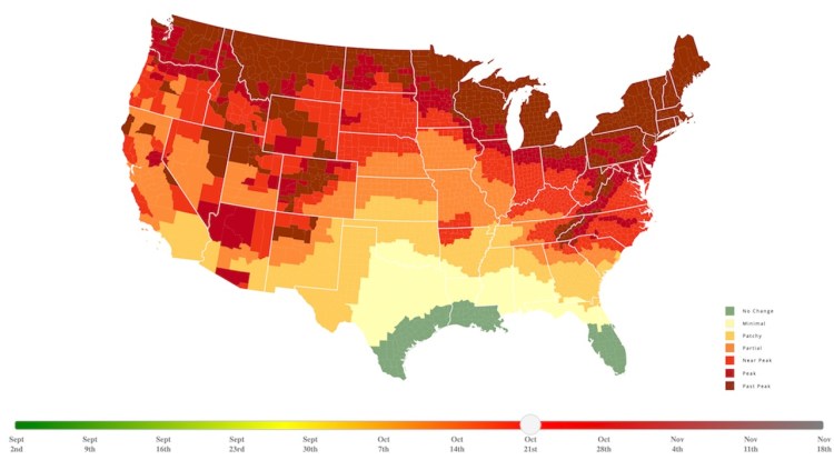
An Interactive Map That Predicts the Fall Foliage Across the United States in 2024
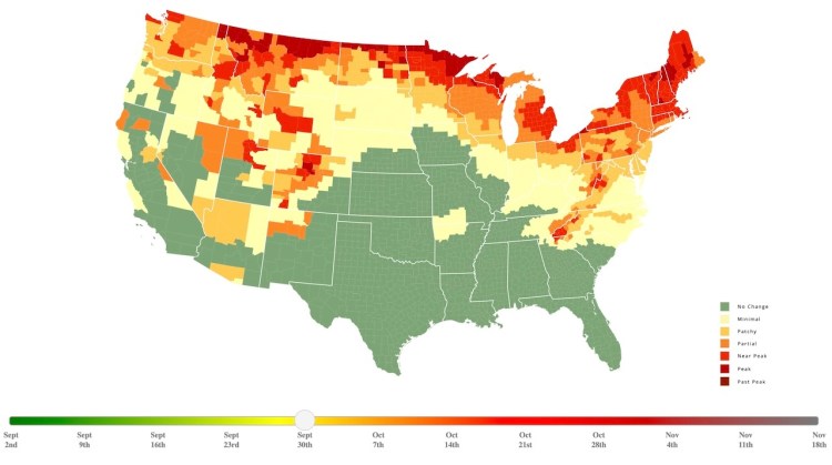
SmokyMountains.com released their annual Fall Foliage Prediction Map for 2024, an interactive map that shows the best time for viewing the changing of leaves across the contiguous United States. As with previous years, users can use a slider to change the time shown on the map to see when the foliage in their area is expected to peak.
The 2024 Fall Foliage Map is the ultimate visual planning guide to the annual progressive changing of the leaves. While no tool can be 100% accurate, this tool is meant to help travelers better time their trips to have the best opportunity of catching peak color each year.
The page also explains why leaves change color in the fall, and the chemical compounds that give them their colors.
It all starts with photosynthesis. Leaves typically produce their vivid hues of green from spring through summer into early fall through the constant creation of Chlorophyll. …Chlorophyll is not the only player in the fall leaf-color game. Present in other leaves and trees are the compounds known as Carotenoids and Anthocyanins. As the Fall days begin to get shorter and shorter, the production of Chlorophyll slows to a halt, eventually giving way to the ‘true’ color of the leaf.