30 Years of Landsat Images Show the Dramatic Shifts in Peru’s Ucayali River Over Time
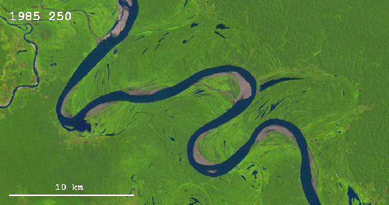
30 years of images and data taken from Landsat satellites were compiled by geologist Zoltan Sylvester to show the dramatic shifts in Peru’s Ucayali river over time.
This river is changing its course with an impressive speed; many – probably most – other rivers don’t show much obvious change during the same 30-year period. What determines the meander migration rate of rivers is an interesting question in fluvial geomorphology.
image via Hinder Settling
via Flowing Data