Inquisitive Man Receives Official Geographically Accurate London Transit Map via Britain’s Freedom of Information Act

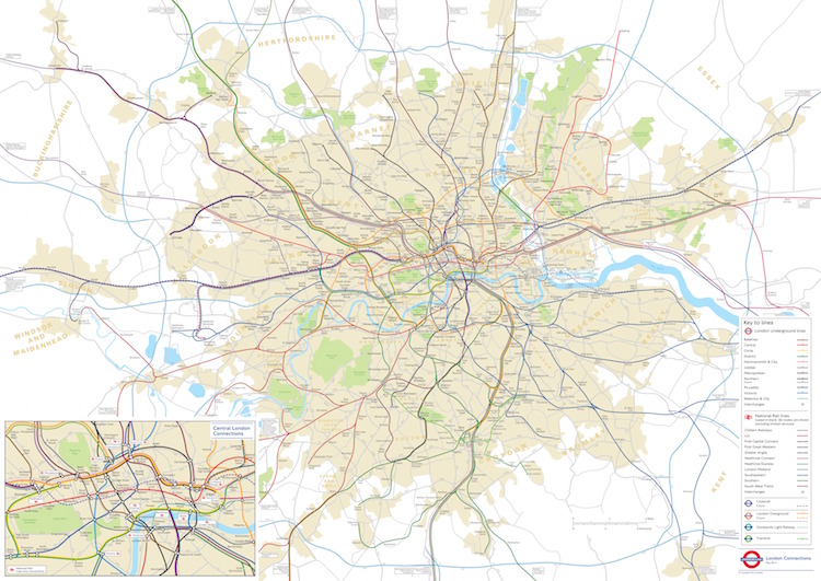
image via WhatDoTheyKnow
In August 2014, WhatDoTheyKnow user James Burbage made an official request to Transport for London, in accordance with the rules of the British Freedom of Information Act, in order to gain access to a geographically accurate transit map that plotted the accurate distance between stations. Surprisingly, Burbage received an acknowledgement within two days and the map just a month later.
Dear Transport for London,
Please supply a geographically accurate map of all the stations,
platforms, lines and tracks that form the London Underground,
London Overground, Docklands Light Railway and National Rail
services where applicable, which is updated as of August/September
2014.Omit information which could pose a concern for health and safety.
Yours faithfully,
J. Burbage
——
Dear Mr BurbageTfL Ref: 0776-1415
Thank you for your email received by Transport for London (TfL) on 13 August 2014. I apologise for the delay in acknowledging your correspondence.
Your request will be processed in accordance with the requirements of the Freedom of Information Act and TfL’s information access policy.
A response will be provided to you by 11 September 2014.
In the meantime, if you would like to discuss this matter further, please do not hesitate to contact me.
Yours sincerely
Jasmine Howard
FOI Case Officer
FOI Case Management Team
General Counsel
Transport for London
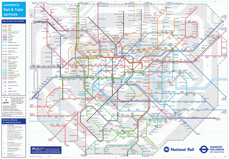
Here’s the more commonly distributed map for comparison.

image via Transit For London


