An Interactive Map of Images Captured by Astronauts From Expeditions 40 & 41 on the International Space Station
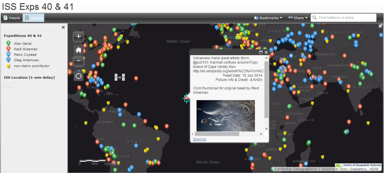
Dave MacLean, who is Centre of Geographic Sciences GIS Faculty at Nova Scotia Community College in Canada, has created an interactive map of images captured by astronauts from Expeditions 40 and 41 on the International Space Station (ISS). Specifically, the map includes images by astronauts Alex Gerst and Reid Wiseman as well as cosmonauts Maksim Surayev and Oleg Artemyev. Each image was pulled from tweets made by the astronauts and cosmonauts. The map also includes the position of the ISS with a one-minute delay.
Volcanoes make great artists @astro_alex pic.twitter.com/xFD2x1lu1N
— Reid Wiseman (@astro_reid) June 12, 2014


