Google Launches Street View Map Feature at Where 2.0
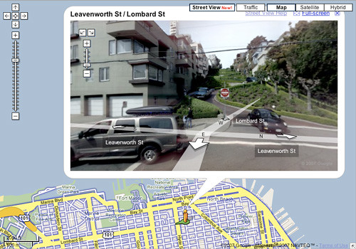
At the Where 2.0 conference today in San Jose, Google announced the launch of Street View, a new feature integrated into Google Maps that shows street level images of the area on the map. Currently Street Views are only available in San Francisco, New York, Las Vegas, Denver and Miami, but more cities will follow in the future. Brady Forrest has more on the launch over on the O’Reilly Radar blog.
Google has created a silly little video showing how the Street View feature works.
Chris LLorca recommends a fun first trip down Lombard Street, San Francisco’s famously crooked street. Just follow this link and head east.
On a related note, Microsoft added a 3D feature to it’s Live Search Maps today for New York City and several other US cities.
UPDATE: Google also released a preview of their new Mapplets feature today, which are small applications that developers can create for Google Maps using the Google Maps API.