A Stunning Google Maps Street View Project That Captures Imagery of Polar Bears In Their Natural Habitat
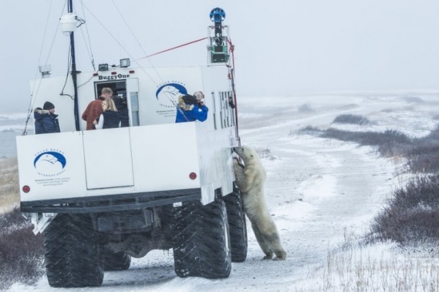
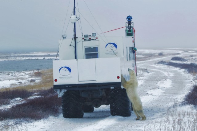
Polar bear conservation group Polar Bears International invited Google to the Canadian Arctic to capture imagery of Ursus maritimus. Between Google Earth Outreach, Google Maps, and Polar Bears International, they captured an extensive amount of Street View imagery of both Churchill, Canada and Wapusk National Park — a small slice of the global natural habitat for polar bears.
We’ve joined forces with Google Maps to collect Street View imagery from a remote corner of Canada’s tundra: Churchill, Manitoba, home to one of the largest polar bear populations on the planet. With the help of outfitters Frontiers North, the Google Maps team mounted the Street View Trekker onto a specially designed “Tundra Buggy,” allowing us to travel across this fragile landscape without interfering with the polar bears or other native species. Through October and November we collected Street View imagery from the shores of Hudson’s Bay as the polar bears waited for the sea ice to freeze over.
via Discovery News