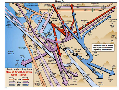
A Roadmap to the Bay Area’s Highways in the Sky
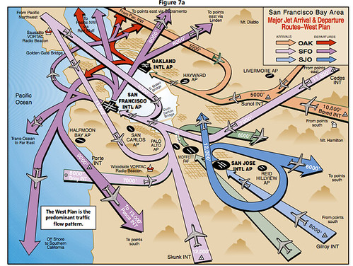
This is a clean version of an illuminating FAA graphic I saw recently on the wall at Moffett Federal Airfield down in Mountain View. It’s a guide to the air traffic routes used at airports around the San Francisco Bay Area — a roadmap of the highways in our skies.
I love it because it explains the patterns behind the air traffic I see jetting over San Francisco every day. It all seems kind of random from the ground, but thanks to this route plan, the flight paths now make a lot more sense.
This second graphic shows the southeast routes the jets use when the winds get funky: