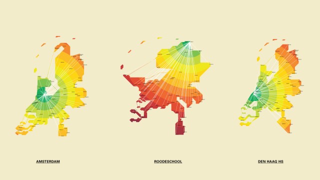
TimeMaps, Interactive Map Showing Trip Duration Instead of Distance
TimeMaps by Dutch designer Vincent Meertens is an elegant interactive travel planner map that displays trip duration as a graphic overlay (demo video). The map currently only exists as a web app that covers the Netherlands, though smartphone apps and a map of New York City are in the works.
Due to the good public transportation in the Netherlands distance has become irrelevant. We can reach almost any destination by train easily and relatively quick. In our busy lives we now think in time rather than distance. Therefore the current maps, as we know them today, are obsolete.


