In August 1972, renowned Italian designer Massimo Vignelli created a beautifully modern streamlined map of the New York city subway that matched the forward thinking attitude of the city, but was eventually cast aside in favor for a more traditional approach. The issue was that Vignelli’s map didn’t pay enough attention to distance between stops or the distance from a stop to a desired location
Unlike the geometric design of the London underground map, which brilliantly employed the simple principle of where to get on and where to get off, New Yorkers and visitors to New York had a more difficult time using that logic, particularly during the 1970s when subway violence was at an all-time high. Riders preferred to spend as little time as possible traveling underground and wanted a subway map that was accurately scaled. So a less attractive, yet more accurate version was implemented in 1979 and iterations of that design are still being used today.
One theory about why this was so upsetting to New Yorkers was that there was a significant crime problem in the 1970s. People wanted to limit their time underground as much as possible Vignelli’s maps so distorted the locations of stops that riders didn’t know where they needed to get off. The anxiety of being lost underground where you were more likely to get mugged or roughed up wasn’t something New Yorkers wanted or needed. Vignelli’s diagrammatic map is easy to look at, the model of the map supports this, but is it good or bad design? …the best map is a map that people will use.
The Vignelli Map, which was spotted at the 57th Street subway stop in 2017.
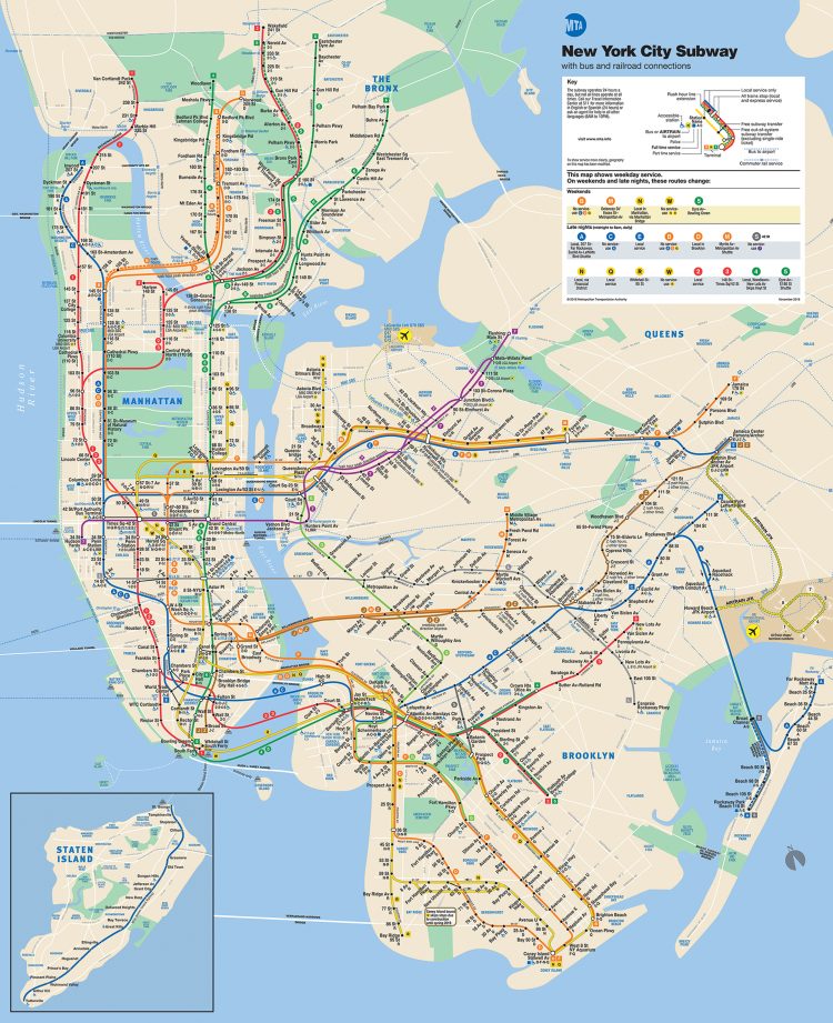
Here’s the most updated version of the official New York City subway map.
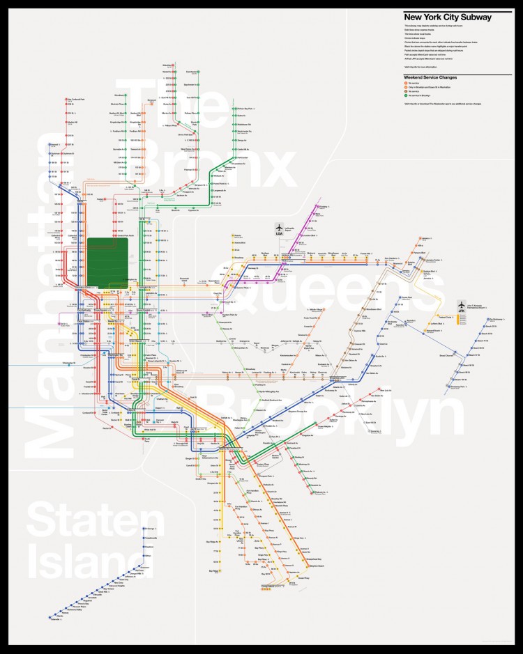
A number of designers have attempted to match the beauty of Vignelli’s attempt with the utility of the current design. One such designer, Tommi Moilanen offered up such an example in 2015.
Subway/metro maps should always look like they belong to the specific city they were designed for and to that specific city only. Design is always context specific and as shown above, New York City, like any other city for that matter, has its own specific features and character that should be reflected in the design.
Vignelli also offered an updated, to scale map redesign in 2008. Unfortunately that wasn’t implemented either.