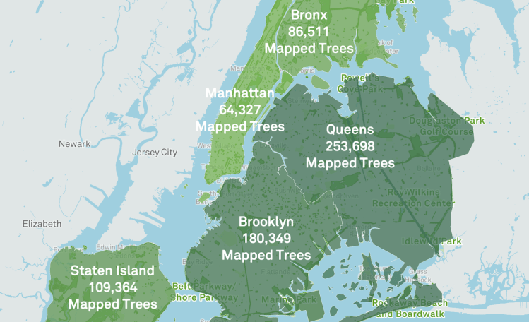
NYC Parks has put together a really wonderful online map of all public trees planted in Manhattan, Brooklyn, Queens, The Bronx and Staten Island, in order to encourage its citizens to become stewards of the urban green spaces within New York City.
The New York City Street Tree Map is the world’s most accurate and detailed map of a city’s street trees. Through this map, you can explore our city’s urban forest, mark trees as favorites and share them with your friends, and record and share all of your caretaking and tree stewardship activities. …The map only shows trees that grow on land under the jurisdiction of NYC Parks.
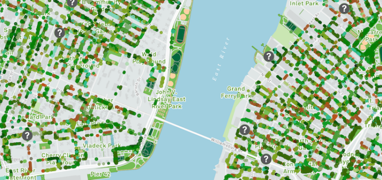
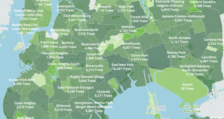
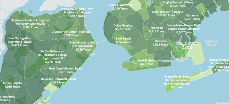
The data was gathered through the Trees Count 2015-2016 Street Tree Census and compiled into an interactive map that details the specific locations of the trees, the type of trees planted in each location, when they were planted, the soil information and the inventory of trees at the location using color codes and circles to indicate species. The map is also searchable by type of tree and can easily zoom to particular neighborhood of interest.
When you filter the map by species, you can find more information on the diversity of street trees within New York City. Each species of tree has been given a different color, and related species have been designated with similar colors. You can also filter trees by ranges of tree diameter and the sizes of the tree points on the map are relative to their size in real life.


via Open Culture