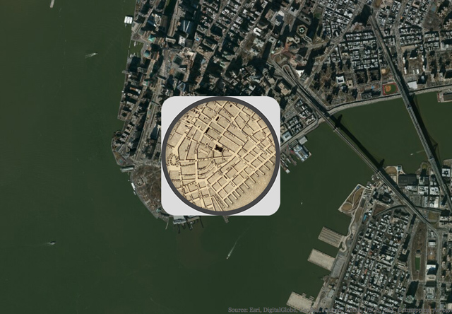
Smithsonian Magazine has posted an interactive map of New York City that compares an 1836 wall map of the city (only partially settled at the time) with aerial imagery of the city in its present state. The magazine has posted then-and-now interactive maps of several other American cities as well. The historical maps are from the David Rumsey Map Collection.
via Digg