San Francisco
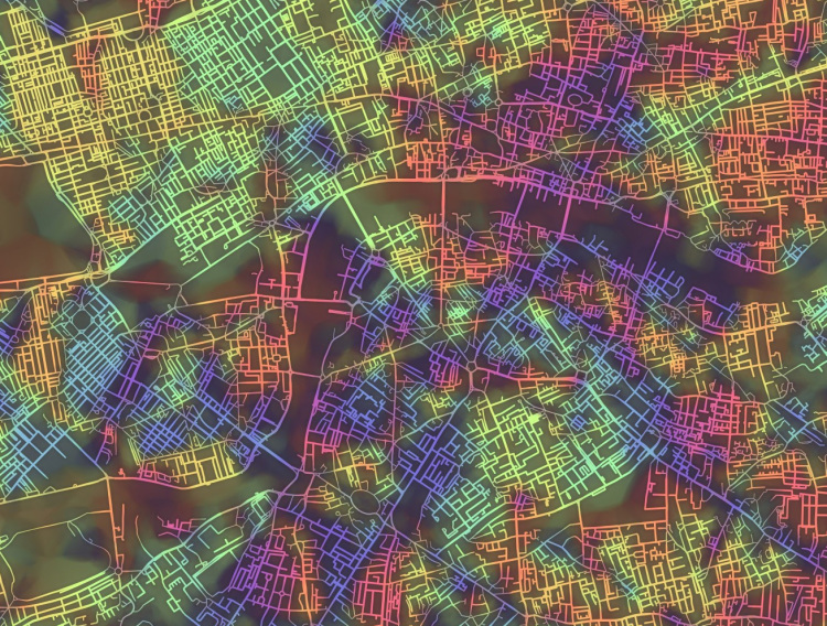
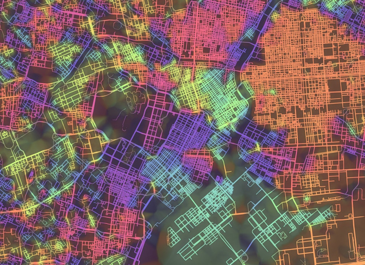
To visualize the various street grid systems of cities around the world, artist and scientist Stephen Von Worley has created Crayon the Grids, a beautiful series of city maps in which the streets have been color-coded based on their orientation. Von Worley created the visualizations algorithmically using OpenStreetMap.

New York City
London

Washington, D.C.
Tokyo
images by Stephen Von Worley
via Flowing Data