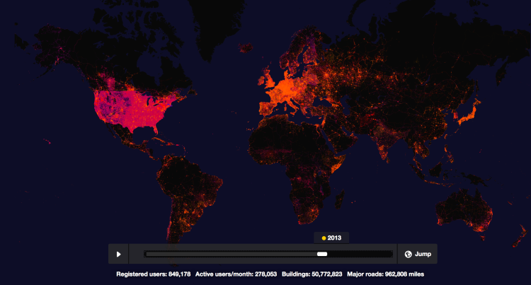
Mapping platform Mapbox is celebrating the 10th anniversary open-source collaborative map project OpenStreetMap (previously) with the creation of an interactive timeline that highlights the inputting of mapping data across the globe over the course of the last decade.
The color you see popping up on this map is the work of hundreds of thousands of people who have mapped more than 25 million miles of roads in every country in the world.
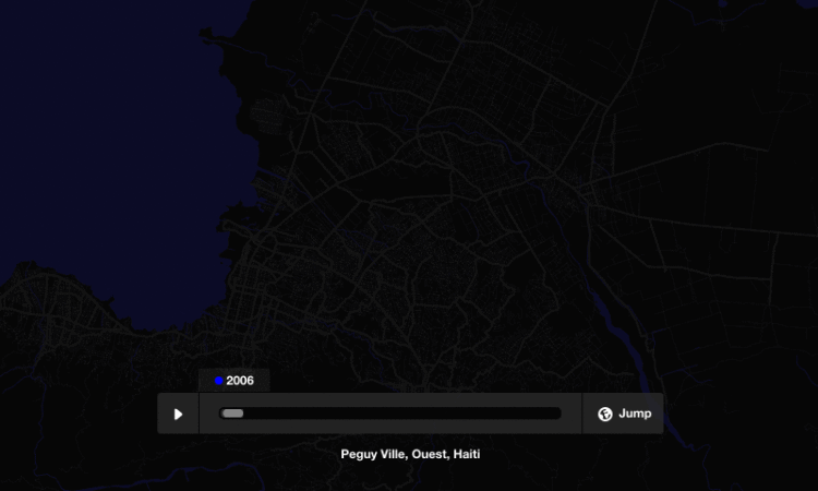
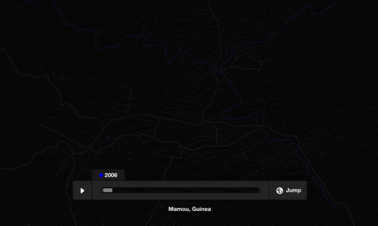
More localized examples of mapping proliferation can be found around events such as the recent Ebola outbreak in Africa and the 2010 Haitian earthquake.
images via Mapbox
submitted via Laughing Squid Tips