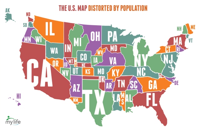
Social networking service MyLife has created a map of the United States using population data estimates from the United States Census Bureau to distort the size of individual states. The state of California is the largest according to this data, and Wyoming is even smaller than the District of Columbia.
submitted via Laughing Squid Tips