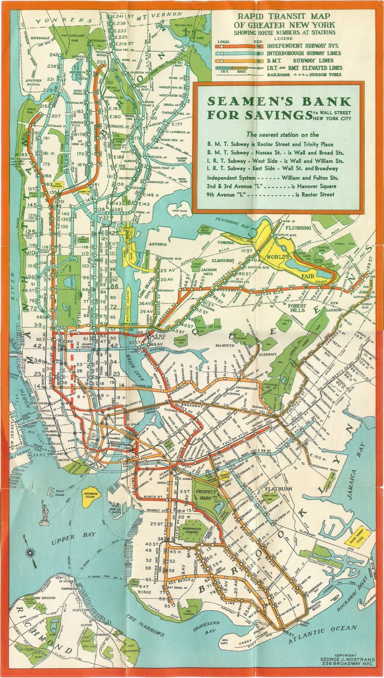
Map aficionado qweqwe321 posted a wonderful subway map from 1939 that had been sponsored by Seaman’s Bank for Savings. The map included all of the “Greater New York” train lines of the time, such as the IND, the BMT and the IRT.
Here’s what New York City looked like that year.
Here’s rare color footage of New York City in 1939, taken by French tourist Jean Vivier.